El Niño divides Africa’s water risks: floods in the east, drought in the south
WaterAid’s analysis of past El Niño events warns that familiar continental maps can miss major differences between African cities. Meteorological forecasts independently support heightened wet and dry risks into 2027, but neither a record event nor a particular disaster is a settled outcome.
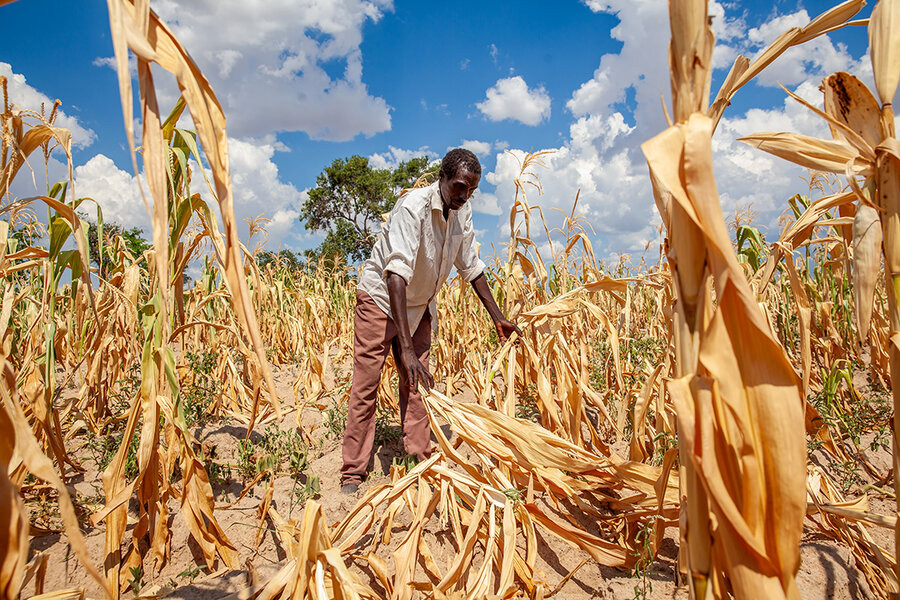
African cities could face sharply different water emergencies during the strengthening 2026–27 El Niño, according to new WaterAid research: heavier rain and flood risk in parts of East Africa, drought pressure across much of Southern Africa and a drying signal along the West African coast.
The warning is not that the continent will experience one uniform disaster. It is that planning around broad regional labels can leave utilities and communities preparing for the wrong hazard. WaterAid’s analysis also identifies exceptions, including a drier tendency in Addis Ababa and a slightly wetter tendency in Cape Town during strong historical events.
Released on 4 November ahead of COP31 in Türkiye, the study examines 20 cities and three African regions. WaterAid is an advocacy organisation, not a meteorological agency. Its findings need to be read alongside current official forecasts, which support concern about a strong event extending into 2027 without guaranteeing a specific local outcome.
What the El Niño forecast actually says
NOAA’s Climate Prediction Center said in its 8 October diagnostic discussion that El Niño was strengthening and likely to remain strong to very strong through January–March 2027. Its 15 October seasonal outlook placed the general peak in the November–January period and favoured El Niño continuing into March–May 2027.
That supports a prolonged planning horizon, rather than a claim that the disruption will end with the calendar year. It does not establish that the event has already reached its peak or become the strongest on record.
WaterAid uses the term “super El Niño” and quotes its lead researcher forecasting exceptional strength. NOAA also assigns substantial probabilities to a historically strong event. But a forecast of a possible record is not an observed record, and a stronger Pacific event does not guarantee proportionately greater rainfall or damage in every African city.
Historical patterns are not a street-level forecast
The methodological notes accompanying WaterAid’s release describe an analysis of monthly CHIRPS rainfall data from 1982 to 2025, using a six-month Standardized Precipitation Index to compare wetter and drier conditions. The researchers related those patterns to a Pacific sea-surface-temperature index, separating El Niño months from very strong-event months.
That approach helps identify where rainfall responses have differed as El Niño strengthened. It does not directly predict a reservoir’s level, the date of a flood or the number of people who will fall ill. Historical rainfall patterns also cannot capture every influence on the coming season.
The city-level claims about Lagos, Monrovia and Addis Ababa come specifically from WaterAid’s analysis. They should not be mistaken for independently verified national forecasts or evidence that all districts within those cities face identical conditions.
East Africa’s flood risk has independent support
ICPAC, the Greater Horn of Africa’s regional climate centre, issued its October–December outlook in August with national meteorological services. It gave a 90% chance of enhanced rainfall in southern Ethiopia, central to southern Somalia and north-eastern Kenya. It also highlighted the likelihood of substantial seasonal rainfall in areas including western Tanzania.
The outlook identified both El Niño and the expected positive Indian Ocean Dipole as relevant influences. It urged users to follow updated national, monthly and shorter-range forecasts. That matters because a seasonal wet signal is not a forecast of when an individual river will overflow.
WaterAid found particularly strong historical wetting signals in Nairobi and Dar es Salaam. Its contrasting Addis Ababa finding does not invalidate ICPAC’s wetter outlook for southern Ethiopia: they concern different places, and a historical association is not the same product as a seasonal forecast. Treating Ethiopia as one rainfall zone would conceal that distinction.
Southern drought and coastal West African drying
The Southern African Development Community’s August outlook independently favoured below-normal rainfall across much of its central and southern region during October–December 2026, with a dry signal persisting across large areas in January–March 2027. Its forecast also identified wetter exceptions in northern and eastern areas.
WaterAid’s historical analysis similarly found progressive drying in cities including Maputo, Lusaka and Johannesburg as El Niño intensified. But Cape Town and Antananarivo did not follow that broad pattern. Those exceptions are a warning against describing every southern African location as destined for extreme drought.
In West Africa, WaterAid places its clearest drying signals in Lagos and Monrovia, while parts of the Sahel showed wetter tendencies. This is a finding from the NGO’s historical analysis, not a continent-wide official drought declaration. The distinction is important for coastal cities that must protect water supply while remaining prepared for damaging downpours.
Why sanitation belongs in the warning
Floodwater can damage sanitation systems and contaminate drinking water; shortages can undermine reliable supply and hygiene. WHO’s cholera fact sheet links outbreaks to limited safe water and sanitation, including disruption associated with floods and drought. Neither the weather pattern nor contaminated infrastructure alone proves an outbreak has occurred.
WaterAid describes practical preparation already under way: protecting pipes and latrines in Lagos, monitoring groundwater and positioning supplies in Madagascar, and rebuilding flood-damaged water systems in Tanzania. These are the organisation’s accounts of its work, not an independently audited inventory of readiness.
The immediate test is whether historical risk maps are translated into local operating decisions before systems fail. Climate information can guide storage, infrastructure protection and surveillance, but it must be updated as the season unfolds. The useful message is not that a single “super” event has predetermined Africa’s next emergency; it is that markedly different hazards require preparation now.